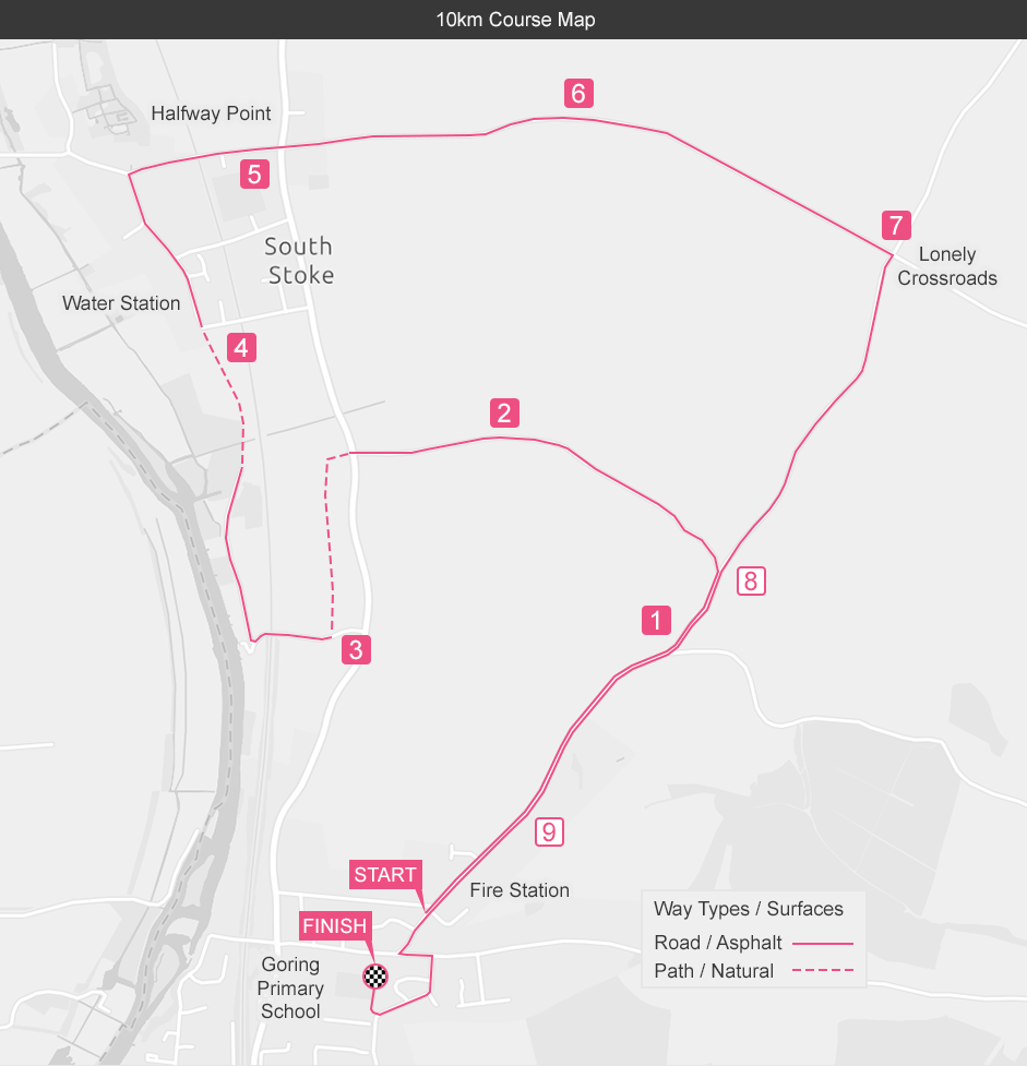
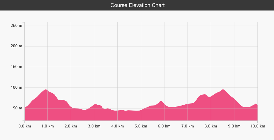
The Goring 10k course starts outside Storton Lodge, the local Scout Centre in the north of the village. It climbs steadily up into the Oxfordshire countryside on quiet country lanes before turning west down Grove Road to cross over Wallingford Road. The route then traverses Hildred's Field (trail).
You then follow the Ridgeway footpath (trail) that runs parallel to the River Thames, rejoining the road through South Stoke Village, where our water station is situated, before rising and falling to the lonely crossroads. Here the course heads south, climbing to the highest point of the course along Icknield Road and then falls all the way to the finish at the Bourdillon Field, behind Goring Primary School.